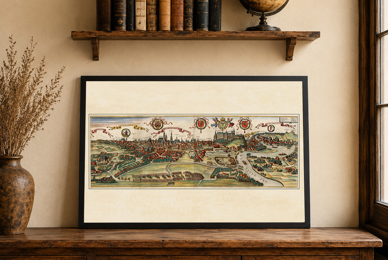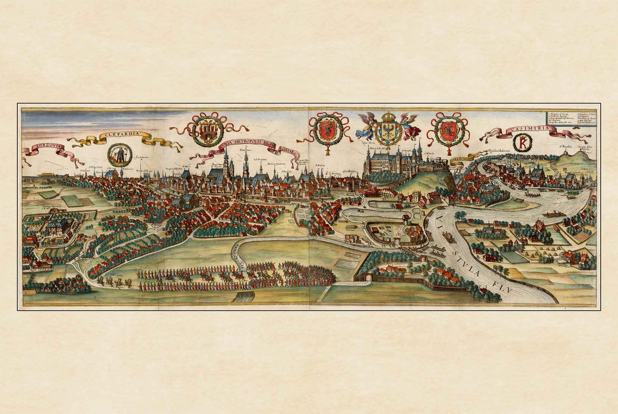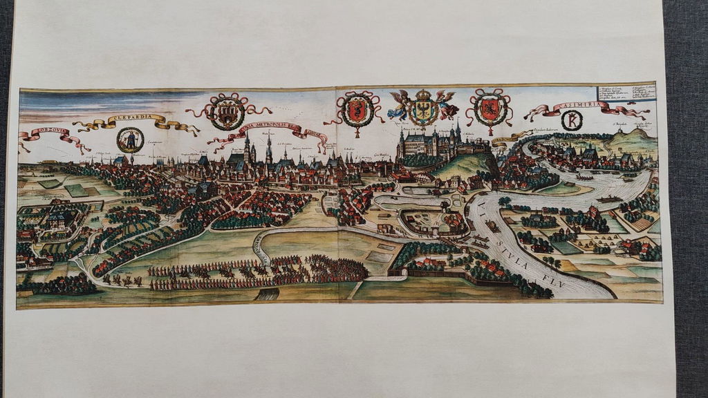


Discover the rich maritime history of Portugal with this stunning Lisbon City Map Poster, featuring the historic engraving "Olissipo" from the celebrated atlas Civitates Orbis Terrarum. Created around 1600 by Georg Braun and Franz Hogenberg, this remarkable bird's-eye view captures Lisbon at the height of the Age of Discovery, when it stood among Europe's most influential ports and trading centers.
Originally published in Volume V of the renowned city atlas and printed by Peter von Brachel, this finely detailed engraving showcases Lisbon's historic streets, churches, castles, civic buildings, and waterfront from an elevated perspective. The carefully engraved composition combines artistic beauty with geographic accuracy, reflecting the exceptional craftsmanship of Renaissance cartography.
The Tagus River is brought to life with magnificent sailing ships that emphasize Lisbon's importance as a global maritime power during the great era of exploration. Decorative coats of arms, an elegant title cartouche, and detailed architectural illustrations enrich the composition, transforming the map into both a valuable historical document and an impressive work of art.
Ideal for history enthusiasts, collectors, travelers, architects, and lovers of antique city maps, this vintage Lisbon poster makes a sophisticated wall decoration for living rooms, offices, libraries, studies, or interiors inspired by European history and classic cartography.
This is a reproduction print of a historical map