



Author: Edward Stanford Ltd.
Year: 1904
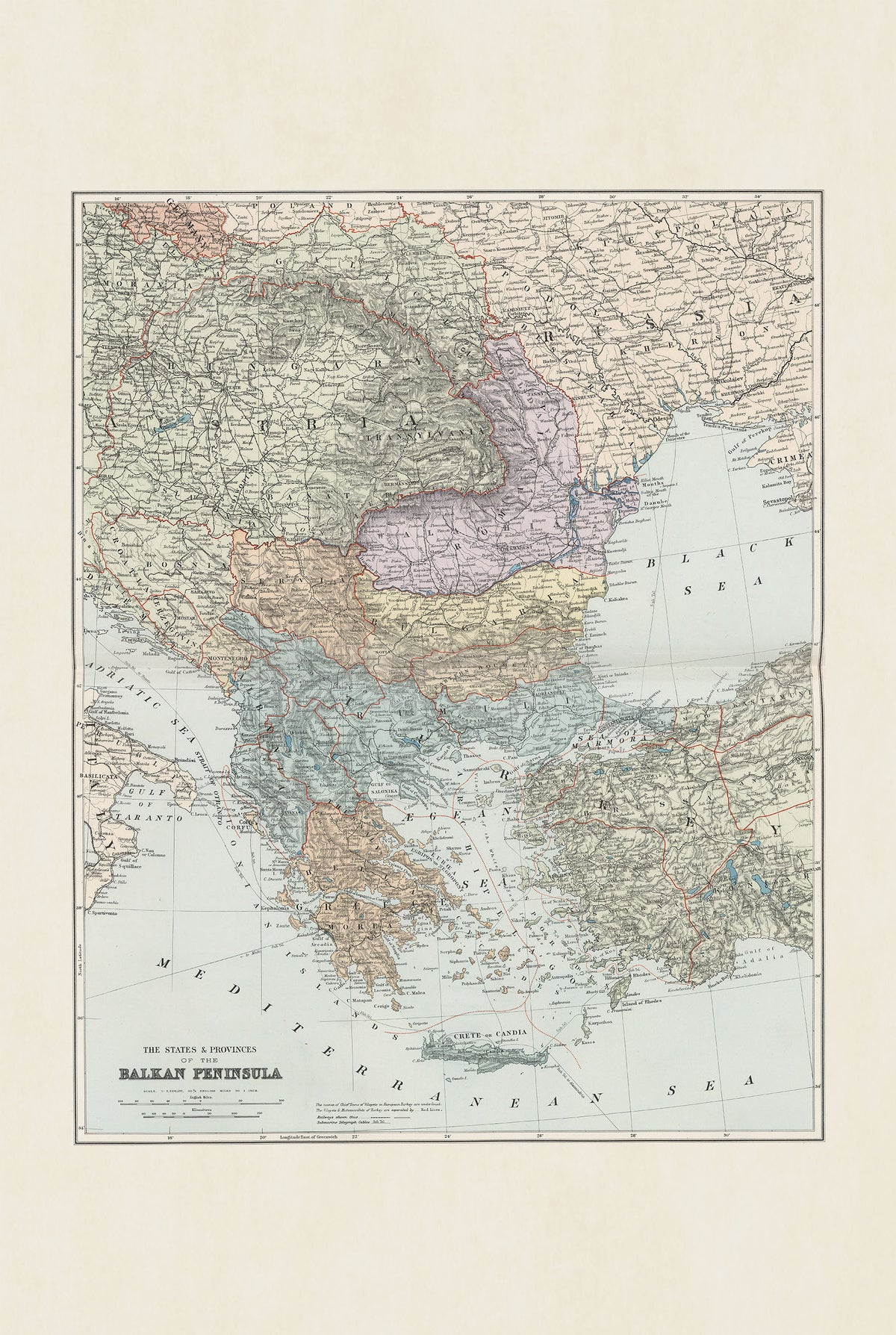
This is a reproduction print of the historical map “The States & Provinces of the Balkan Peninsula”, published by Edward Stanford in 1904 as part of the third edition of his world atlas.
The detailed map depicts the Balkan Peninsula at the beginning of the 20th century, covering territories corresponding to modern-day Greece, Turkey, Bulgaria, Romania, and neighboring regions. Colored boundaries distinguish the different states and provinces, while major cities, settlements, roads, railways, and submarine telegraph cables are carefully marked.
Printed using full-color lithography, the map uses hachures to represent mountainous terrain and has a scale of 1:3,220,177. Its historical borders provide a fascinating snapshot of the Balkans shortly before the Balkan Wars and the major geopolitical changes that would reshape the region.